30 Sep 2021 Landsat 9
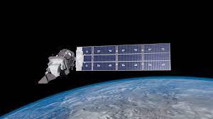
- Landsat 9 was recently launched by NASA.
About Landsat 9:
- It is an Earth monitoring satellite.
- It is a joint mission of NASA and the US Geological Survey (USGS).
- Together with Landsat 8, it will collect images of Earth’s surface. It takes 8 days to capture the whole Earth.
- It is the most technologically advanced satellite of its generation. It can see more colour shades with greater depths than the previous satellites, helping scientists capture more details about our ever-changing planet.
- The instruments aboard Landsat 9 are the Operational Land Imager 2 (OLI-2) and the Thermal Infrared Sensor 2 (TIRS-2). They will measure different wavelengths of light reflected off the Earth’s surface.
About the Landsat series:
- The first Landsat satellite was launched in 1972 and since then, Landsat satellites have collected images of our planet and helped understand how land usage has changed over the decades.
Significance and applications of Landsat missions:
- In 2008, it was decided that all Landsat images will be free and publicly available and the policy has helped scores of researchers, farmers, policy analysts, glaciologists, and seismologists. Landsat images have been used to study the health of forests, coral reefs, monitor water quality and melting glaciers.
How will the satellite help monitor climate change?
- If a forest is affected by drought, it will be seen in Landsat images and can help the researchers decode the areas at risk.
- Similarly during a wildfire, the Landsat images will capture the plumes of smoke and help study the extent of a burning.
- The satellite images can also help recovery experts plan sites for replanting.
- Landsat images can also help identify water bodies affected by potentially harmful algal blooms.
No Comments