23 May 2022 Pangong Tso Lake
Pangong Tso Lake – Today Current Affairs
- India is closely monitoring the construction of a bridge by China over the Pangong Tso Lake in ‘East Ladakh’.
Related case:
- The People’s Liberation Army (PLA) of China has a garrison at the ‘Kurnak Fort’ on the north bank of the ‘Pangong Tso’ lake and the ‘Moldo’ on the south bank of the lake. , and the distance between the two fronts is about 200 km.
- The distance between the nearest points on both the northern and southern banks of the ‘Pangong Tso’ lake is about 500 meters, and in the meantime China is building a new bridge, after which the movement between the two sectors will take about 12 hours. The time will be reduced to just three or four hours.
- This will reduce the time it takes for the People’s Liberation Army (PLA) to move troops and equipment between the two fronts.
- This bridge is located about 25 km ahead of the Line of Actual Control (LAC).
Today Current Affairs
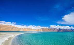
About Pangong Tso
- Pangong Tso literally means “Conclave Lake”. In Ladakhi language Pangong means proximity and in Tibetan language Tso means lake.
- Pangong Tso is a long narrow, deep, land-locked lake situated at an altitude of more than 14,000 feet in Ladakh, its length is about 135 km.
- It is formed from Tethys land formation.
- It is a salt water lake. The Hindu Analysis
- The Karakoram mountain range, which has a number of hills over 6,000 meters, including K2 the world’s second highest peak, runs through Tajikistan, Afghanistan, Pakistan, China and India and ends at the northern edge of the Pangong Tso.
- On its southern bank also there are high fractured mountains sloping towards Spangur Lake.
- The water of this lake, although clean as glass, is not potable due to being ‘saline’.
Reason for controversy at this location : The Hindu Analysis
- Line of Actual Control (LAC) – Generally this line passes through the site leaving the width of Pangong Tso and since the year 1962 divides Indian and Chinese troops. This line passes through water in the Pangong Tso area.
- Both sides have declared their respective territories, marking their territories.
- India controls the Pangong Tso area for a distance of 45 km, and the rest of the lake is controlled by China.
What are Fingers? The Hindu Analysis
- In Pangong Tso Lake, the hills of the ‘Chang Chenmo range’ are forward, called ‘Fingers’.
- 8 of these fingers are disputed. In this area, there is a difference of opinion between India and China regarding the LAC.
- India claims that the LAC passes through Finger 8, and this is the last army post of China.
- India patrols this area, up to Finger 8, on foot due to the structure of this area. But the control of the Indian Army is only till finger 4. The Hindu Analysis
- On the other hand, China says that the LAC passes through Finger 2. The Chinese army patrols with light vehicles up to Finger 4 and sometimes till Finger 2.
Reason for Chinese encroachment in Pangong Tso area : The Hindu Analysis
- Pangong Tso Lake is close to the strategically important Chushul Valley. The main attack by China during the 1962 war was launched from the Chushul Valley.
- The path to the Chushul Valley passes through Pangong Tso Lake, a major route China could use to capture Indian-occupied territory. The Hindu Analysis
- China also does not want India to expand its infrastructure anywhere near the LAC. China fears this could threaten its rights on Aksai Chin and the Lhasa-Kashgar highway.
- Any threat to this highway could hamper Chinese imperialist ambitions in Ladakh and Pakistan-occupied Jammu and Kashmir.
No Comments